
Trailhead: Beus Canyon Trailhead, WSU, 29th, 27th, 22nd and 21st streets
Difficulty: Stroll in the park
Distance: 5.5 miles
Average Time: 2-3 hours
Suggested water amount: 1 ½ gal.
Precautions: Bikers, hikers and animals

The Bonneville Shoreline Trail extends across four counties in Utah, from Box Elder to Salt Lake County. The Shoreline was created geologically 14,500 years ago when the Bonneville Flood, the second largest in geologic history, broke through Red Rock Pass in Idaho, draining Lake Bonneville to the Provo Shoreline level where most of the trails formed.
The Mount Ogden section of this trail runs from Beus Canyon north to Ogden Canyon at a total distance of 6.4 miles. The Shoreline Trail is a series of trails that interconnect to make up the system. That interconnection can be confusing but will allow a hiker to gain more experience without causing a bad day or bodily harm.
This trail is the one that connects all trails. Whether it be Waterfall Canyon, Indian Trail, Malan’s or Mount Ogden, they all start with the Shoreline Trail.
The Shoreline Trail is a long, relatively flat trail, but it does have some elevation gains the farther south you travel. This provides an excellent opportunity for a hiker to develop endurance training for longer, steeper hikes.
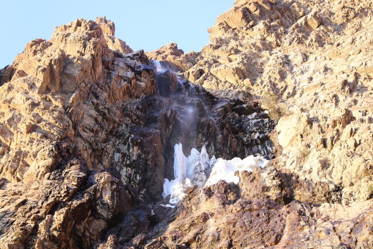
While taking the trail from the Beus Canyon Trailhead on 4600 South to 21st Street, which provides an impressive view of the Ogden Canyon Waterfall, I was stopped by Valecia Baird, an Ogden resident. After starting with a conversation about my tattoos, she reminded me that you should keep your pets on a leash because not all animals are sweet and friendly.
Traci Jacobson, a Weber State Wellness Center employee, caught me on the trails after reading a few of my articles. Mentioning trail safety, Jacobson brings her dog to ward off would-be troublemakers but recommends that people should bring something just in case, whether it be mace, pepper spray or a few friends to make sure you always have an enjoyable trail experience.
There are many access points to this trail across the state. When it’s connected and completed, it will stretch 150 miles from Logan to Nephi and be within 20 miles of 80 percent of Utah’s population.
For more detailed maps, information and history, please visit the Bonnevilleshorelinetrail.org.